Forgotten History
Castle de Kolck
Netherlands
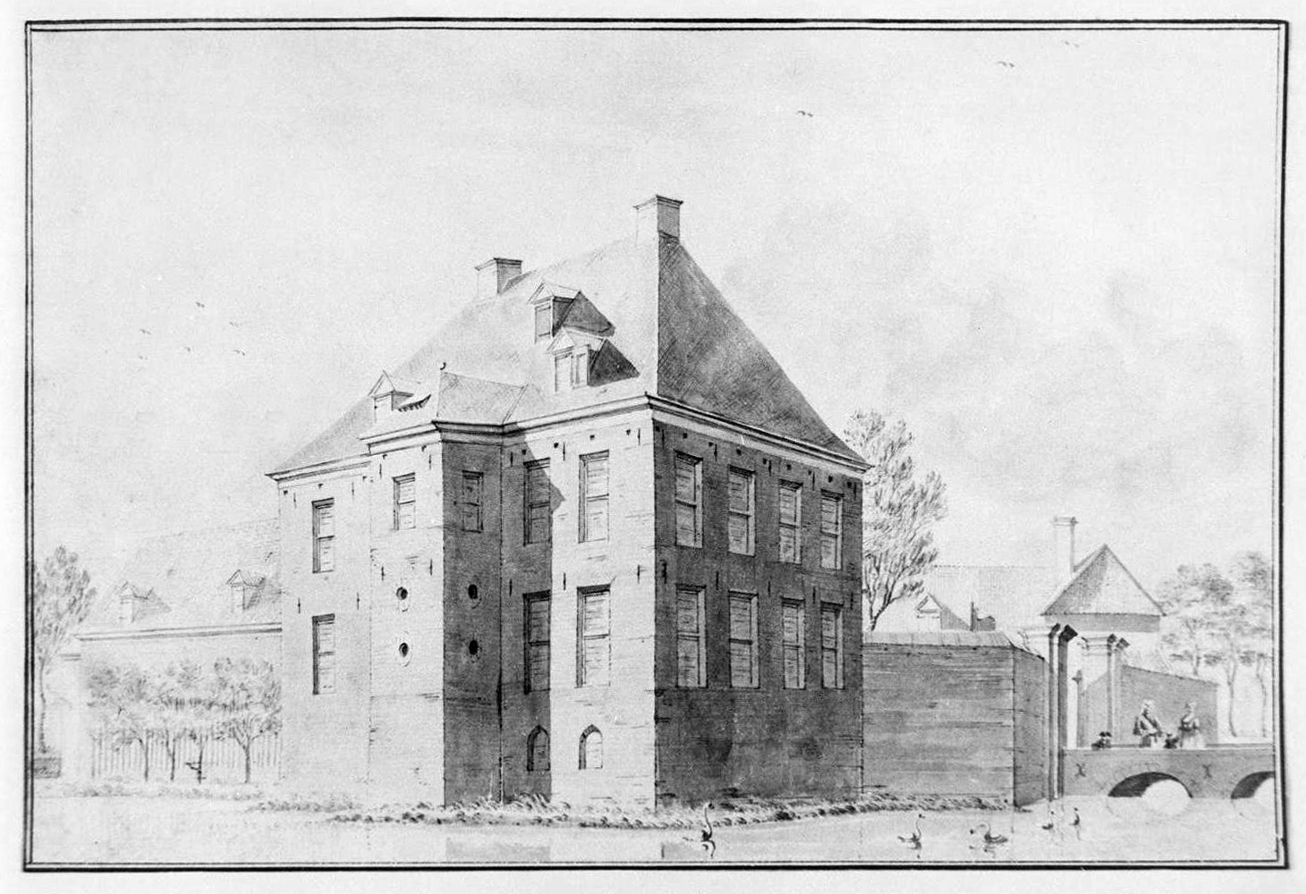
De Kolck Castle was a noble country house on the southwest side of Broekhuizenvorst, located on the road to Swolgen. There is a known image by Abraham de Haen from the second half of the 18th century, which shows a rectangular house with a stairwell in the middle at the rear. The attic consists of two floors and some windows. The roof has two chimneys.
- Category
- Forgotten History
- Location
- Netherlands
- Address
- Swolgenseweg 23
- Coordinates
- 51.49222, 6.15250
- How to get there
- Google MapsApple MapsOpenStreetMap
- Wikidata
- Q4313829
What is Castle de Kolck?
Castle de Kolck is a Forgotten History place on VeroMaps, on Swolgenseweg 23. Other places close by: Onze-Lieve-Vrouw-Sterre-der-Zeekapel, Heilige Naam Jezuskerk, Onze-Lieve-Vrouw-van-Zeven-Smartenkapel, Sint-Christoffelkapel.
Where is Castle de Kolck?
Castle de Kolck is in Netherlands. Coordinates: 51.49222, 6.15250.
How do I get to Castle de Kolck?
Castle de Kolck is at Swolgenseweg 23, Netherlands (51.49222, 6.15250). Enter these coordinates in Google Maps, Apple Maps or OpenStreetMap for walking, cycling or driving directions.