Forgotten History
Carrick Castle
Argyll and Bute, United Kingdom
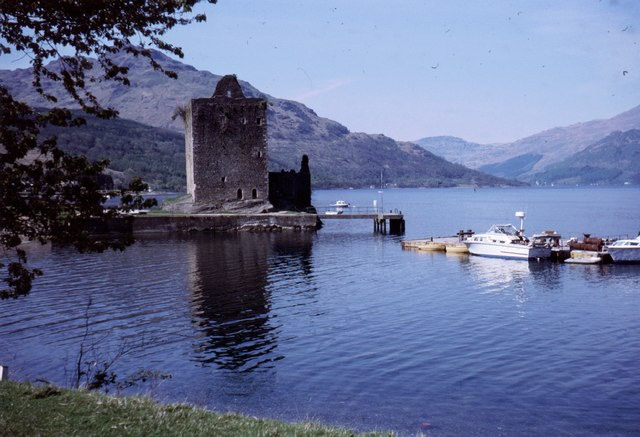
Carrick Castle is a 14th-century tower house on the west shore of Loch Goil on the Cowal Peninsula, in Argyll and Bute, west of Scotland. It is located between Cuilmuich and Carrick, 4 miles (6.4 km) south of Lochgoilhead. The castle stands on a rocky peninsula, and was formerly defended to landward by a ditch and drawbridge. The building is around 66 by 38 feet (20 by 12 m), and up to 64 feet (20 m) high with walls seven feet thick. It consists of two floors above the central great hall and stands 64 feet high. There is a curiosity – a small chimney is built into a window recess. There is an appendage of a smaller 17th century structure to the original rectangular tower house. The structure has been designated a scheduled monument and a Category A listed building by Historic Environment Scotland. Modern-day houses in the surrounding area take the name Carrick Castle.
- Category
- Forgotten History
- Location
- Argyll and Bute, United Kingdom
- Coordinates
- 56.10881, -4.90562
- How to get there
- Google MapsApple MapsOpenStreetMap
- Wikidata
- Q32698
What is Carrick Castle?
Carrick Castle is a Forgotten History place on VeroMaps. Other places close by: Whistlefield Inn, Benmore Botanic Garden, Ardencaple Hotel Including Former Stables, Rhu Road Lower, Rhu, Ardencaple Castle.
Where is Carrick Castle?
Carrick Castle is in Argyll and Bute, United Kingdom. Coordinates: 56.10881, -4.90562.
How do I get to Carrick Castle?
Carrick Castle is at Argyll and Bute, United Kingdom (56.10881, -4.90562). Enter these coordinates in Google Maps, Apple Maps or OpenStreetMap for walking, cycling or driving directions.