Forgotten History
Barlham
Doetinchem, Netherlands
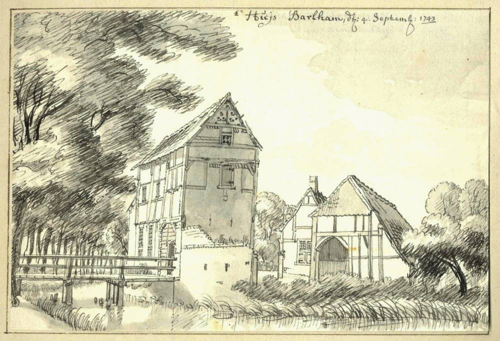
Barlham was a manor in Gelderland, located west of the city of Doetinchem and east of the Doetinchem church village of Wehl and south of the hamlet of Langerak. Traces of a wooden building have been found, possibly from the 10th or 11th century. In the 13th century the wooden building was replaced by a stone castle. The castle complex consisted of a outer castle, a main castle and a figure-eight moat.
- Category
- Forgotten History
- Location
- Doetinchem, Netherlands
- Address
- Barlhammerweg 30, Doetinchem
- Coordinates
- 51.97838, 6.23887
- How to get there
- Google MapsApple MapsOpenStreetMap
- Wikidata
- Q2553795
What is Barlham?
Barlham is a Forgotten History place on VeroMaps, on Barlhammerweg 30. Other places close by: Keppel Castle, Predik het Evangelie, Saint Catharinachurch, Driekoningenkapel.
Where is Barlham?
Barlham is in Doetinchem, Netherlands. Coordinates: 51.97838, 6.23887.
How do I get to Barlham?
Barlham is at Barlhammerweg 30, Doetinchem, Netherlands (51.97838, 6.23887). Enter these coordinates in Google Maps, Apple Maps or OpenStreetMap for walking, cycling or driving directions.