Local Legends
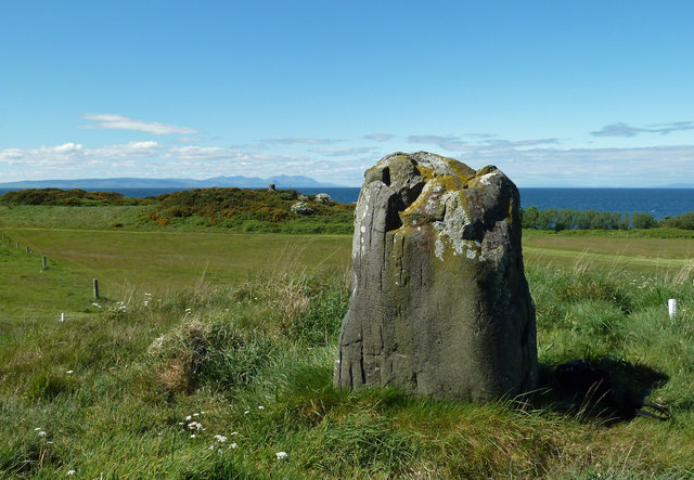
Bains Hill standing stone
Girvan, United Kingdom
Der strandnahe Menhir von Bains Hill (auch Bain’s Hill, Stinnin Stane, Maidenhead Bay, Pan Knowes oder Rab’s Knowe genannt) ist ein Doleritmenhir (englisch Standing stone) auf der Südseite der Maidenhead Bay, westlich von Maidens bei Turnberry in South Ayrshire in Schottland.
- Category
- Local Legends
- Location
- Girvan, United Kingdom
- Coordinates
- 55.33098, -4.82718
- How to get there
- Google MapsApple MapsOpenStreetMap
- Wikidata
- Q56294739
What is Bains Hill standing stone?
Bains Hill standing stone is a Local Legends place on VeroMaps. Other places close by: Turnberry Castle, Turnberry Lighthouse, Culzean Castle, Thomaston Castle.
Where is Bains Hill standing stone?
Bains Hill standing stone is in Girvan, United Kingdom. Coordinates: 55.33098, -4.82718.
How do I get to Bains Hill standing stone?
Bains Hill standing stone is at Girvan, United Kingdom (55.33098, -4.82718). Enter these coordinates in Google Maps, Apple Maps or OpenStreetMap for walking, cycling or driving directions.