Photo corners
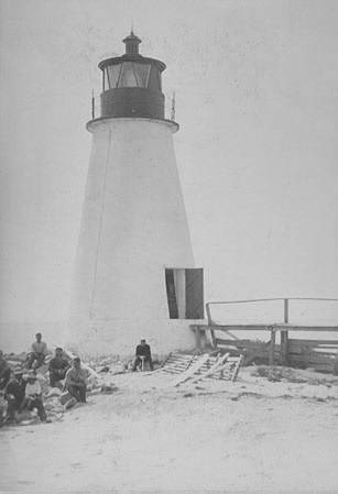
Back River Light
Hampton, United States
The Back River Light, also known as the Grandview Light, was a lighthouse south of the mouth of the Back River on the western shore of the Chesapeake Bay, several miles north of Fort Monroe near Hampton, Virginia. Plagued by erosion for most of its existence, it was destroyed in 1956 by Hurricane Flossy.
- Category
- Photo Spots
- Location
- Hampton, United States
- Coordinates
- 37.08720, -76.26980
- How to get there
- Google MapsApple MapsOpenStreetMap
- Wikidata
- Q4839150
What is Back River Light?
Back River Light is a Photo Spots place on VeroMaps. Other places close by: The Chamberlin, Hampton Coliseum, Ferguson Center for the Arts, Norfolk Botanical Garden.
Where is Back River Light?
Back River Light is in Hampton, United States. Coordinates: 37.08720, -76.26980.
How do I get to Back River Light?
Back River Light is at Hampton, United States (37.08720, -76.26980). Enter these coordinates in Google Maps, Apple Maps or OpenStreetMap for walking, cycling or driving directions.